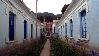
Next morning I started to walk down the streets around Calle 11. It was colder that I expected but then I heard of the snowstorm that brought London's transport system to a complete standstill!
It was pretty early as I woke up at 5:00 am.
Bogotá has over one thousand localities, forming an extensive network of neighbourhoods. Areas of higher economic status tend to be located to the north and north-east, close to the foothills of the Eastern Cordillera. Poorer neighbourhoods are located to the south and south-east, many of them squatter areas. The middle classes usually inhabit the central, western and north-western sections of the city.
The urban layout in the centre of the city is based on the focal point of a square, Plaza Bolívar, typical of Spanish-founded settlements, but the layout gradually becomes more modern in outlying neighbourhoods. The current types of roads are classified as Calles (streets), which run perpendicular to the Cordillera, with street numbers increasing towards the north, and also towards the south from Calle 1. Carreras (Avenues) run parallel to the hills, with numbering increasing as one travels east or west of Carrera 1 (other types of roads more common in newer parts of the city may be termed Eje (Axis), Diagonal or Transversal).


DE TU PRIMO KAREL...
ReplyDeleteCOMO TODO LO QUE HACES CARIÑO, ME HA ENCANTADO. SEGURO QUE TU ESTANCIA EN COLOMBIA SERÁ UNA EXPERIENCIA INOLVIDABLE Y ENRIQUECEDORA EN MUCHOS ASPECTOS.
Ánimo, me parece complicado mezclar la estética "occidental" y otro concierto de colores y ritmos y olores. Acércanolos.
ReplyDeleteQuivo Juan, me encanta tu blog! mezclandote en la cultura y el tiempo de Bogota. Cuidate mucho y disfruta
ReplyDelete